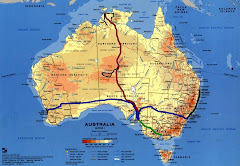
In Alice Springs awaited me a three day tour covering the Outback Icons. Departing from Alice Springs the next morning around 6 am in the dark (- _- zzz), we headed south, stopping for a short visit at an Outback Camel Farm (where one could try a camelride).

A so called Desertship. looks moody to me even so I learned that Camels are told to be more gentle than horses. Might be but they do not look like it!
 Ok it is sooo cute!
 Wow - our Outback vehicle! Compfy and cool inside!
After an Airport Stop to pick up additional guests we headed to a permanent campsite for lunch. The the afternoon was spent exploring Kata-Tjuta (The Olgas). We went for a walk to admire the beauty of the 36 magical domes (of which we ca saw 6 ;) and learn about unique fauna, flora explained by our guide.

Later we went on to Ayer’s Rock. At sunset we hoped to see the spectacular colour changes of Uluru. Unfortunately the sun was hidden behind clouds so there wasn’t much of a sunset. Our group contained of two French girls, 2 Danish couples, a Canadian girl, an Italian couple (he speakes german, she speakes English and both Italian ;) and 2 german couples with an additional geramn tourguide.
The next day we had to get up at 5:30am to make it for views of sunrise at Uluru. We went for a base tour of Uluru walking 10km in 2 hours, exploring ancient caves where Aboriginal paintings can be seen (To be honest I haven’t seen much ;).

Uluru, also referred to as Ayers Rock, is a large sandstone rock formation in the southern part of the Northern Territory, central Australia. It lies 335 km (208 mi) south west of the nearest large town, Alice Springs; 450 km (280 mi) by road. Kata Tjuta (The Olgas) and Uluru are the two major features of the Uluru - Kata Tjuta National Park. Uluru is sacred to the Pitjantjatjara and Yankunytjatjara, the Aboriginal people of the area. It has many springs, waterholes, rock caves and ancient paintings. Uluru is listed as a World Heritage Site.
 And the stone does changes it's color! From dull brown to gleaming red.
Uluru is one of Australia's most recognisable natural icons. The world-renowned sandstone formation stands 348 m (1,142 ft) high (863 m/2,831 ft above sea level) with most of its bulk below the ground, and measures 9.4 km (5.8 mi) in circumference.

Uluru is an inselberg, literally "island mountain", an isolated remnant left after the slow erosion of an original mountain range. Uluru is also often referred to as a monolith, although this is a somewhat ambiguous term because of its multiple meanings, and thus a word generally avoided by geologists. The remarkable feature of Uluru is its homogeneity and lack of jointing and parting at bedding surfaces, leading to the lack of development of scree slopes and soil. These characteristics led to its survival, while the surrounding rocks were eroded. Uluru is dominantly composed of coarse-grained arkose, a type of sandstone characterized by an abundance of feldspar, and some conglomerate.[4][6] Average composition is 50% feldspar, 25–35% quartz and up to 25% rock fragments; most feldspar is K-feldspar with only minor plagioclase as subrounded grains and highly altered inclusions within K-feldspar.
 Remindes me of icecream but my follows could not share that impression of mine they said. :)

 What a stunning beauty. Just the perfect day to enjoy it!

 A crocodile trap!!!


 Sunset in Darwin.


_svg.PNG)